The Parish of Cople in General
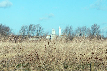
Sand and gravel workings seen from Bedford Road February 2008
Landscape
Cople is a long, slim parish extending southward around 4 miles east of Bedford. Volume III of The Victoria County History for Bedfordshire was published in 1912. At that time the parish consisted of about 2,132 acres of which 1,352.25 were used for arable, 560 for permanent grass and only 4.25 acres were woodland. Crops included wheat, barley, peas and turnips.
The land is low-lying, the highest point being 200 feet above sea level at Moxhill. Most of the village stands about 80 to 90 feet above sea level - the church is at 92 feet and Turnpike Cottage at 86 feet.
The solid, or underlying geology is Oxford Clay, a mudstone laid down between 154 and 164 million years ago in the warm, shallow seas of the Jurassic Period. The superficial geology in most of the village is sand and gravel of river terrace deposits. There is a large sand and gravel pit in the north-east of the parish and in the name of the ‘Gravel Pit Spinney’ and numerous ‘finger pools’ at the north end of the village and in Cople Pit Nature Reserve to the west. There is now a Community Woodland in Dog Field just south of Bedford Road.
Cople is bordered to the west by Cardington, north by Bedford (formerly Goldington) and Renhold, east by Willington and south by Old Warden.
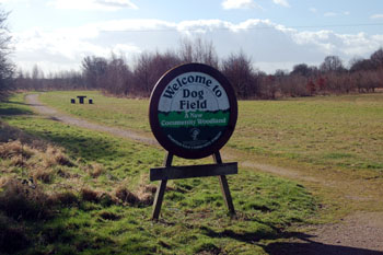
Dog Field Community Woodland February 2008
Name
Cople is first mentioned in the Domesday Book of 1086 as Cochepol or Chochepol. The name derives from the Old English, meaning either the pool of a man called Cocca-- so ‘Cocca's pool’-- or a pool where there are cocks or wild birds, so ‘cock's pool’. The name has undergone a large number of changes over the years as follows: Cogopol (c.1150); Coggepol and Coggepole (c.1150-1227); Coggispol (1195); Cogepol (1202); Cokepol (1227); Cokkepol and Cockepol (c.1230); Cowepol (C13th-15th); Coupel (1240-1276); Coupol and Coupole (1247-1382); Caupel or Caupol (1247-1276); Coupul (1361); Coupulle (1388-1434); Coupell (1402); Coupehill (1461); Copull or Coupull (1509); Coople (c.1530); Cowple (1535); Cowpull (1535); Copull (1549).
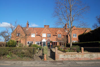
Duke of Bedford cottages of 1856 along Grange Lane February 2008
Administrative history
Cople is an ancient parish. It had at least two ends, Water End, to the south of the village and Coplewood End (first mentioned in 1276) in the south of the parish around Coplewood Farm. The hamlet of Moxhill is first mentioned in the Quarter Session records of 1776 but is now just a farm in the far south-east of the parish.
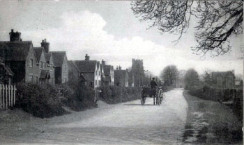
Grange Lane about 1900 [Z1306]
Population
The Domesday Book of 1086 records seven villagers, three smallholders and two slaves in Cople, in addition to the eight tenants. If this figure is multiplied by four to allow for women and children it gives a population of somewhere around eighty.
The Hearth Tax of 1671 (transcribed in Bedfordshire Historical Records Society Volume 16 in 1934) records 59 dwellings in Cople for a total of 139 hearths. It has been estimated that this represented a population of about 238. The largest number - twenty seven - were in the house of Oliver Luke. The houses of Oliver Eaton and Robert Palmer each contained a forge, clearly suggesting they were smiths. Four almshouses were recorded.
Volume 81 published by the Bedfordshire Historical Records Society (2002) is devoted to returns made during episcopal visitations to the county by the Bishop of Lincoln in the early 18th century, edited by former County Archivist Patricia Bell. One of the questions asked was the number of nonconformist families in the parish; the various responses were as follows:
- 1706: 70 families;
- 1709: 71 families "souls about 300";
- 1717: "above forty familys [sic]";
- 1720: "about 70 Familys [sic]"
The population of Cople has rather wavered over the decades, going from 403 in 1801 to 552 in 1851, then back down to 377 in 1901; by 1951 it had revived to 479, and in 2001 stood at 736. It dropped roughly 20% between 1871 and 1881, from 560 to 459. The lowest population figures were recorded in 1901 and 1911-- 377 at each count. There was a significant rise of around 30% in the ten years between 1951 and 1961, leaping from 479 to 687. The highest population to date was recorded in 1981, with 810 inhabitants counted.
The figures for the last two hundred years are as follows:
- 1801: 403;
- 1811: 442;
- 1821: 524;
- 1831: 643;
- 1841: 551;
- 1851: 552;
- 1861: 565;
- 1871: 560;
- 1881: 459;
- 1891: 424;
- 1901: 377;
- 1911: 377;
- 1921: 403;
- 1931: 405;
- 1951: 479;
- 1961: 687;
- 1971: 655;
- 1981: 810;
- 1991: 744;
- 2001: 736;
- 2011: 722.