Beeston Maps
The following maps are only a selection of those held at Bedfordshire and Luton Archives and Records Service.
Beeston was regarded as part of the parish of Northill in 1783 when the inclosure map for that parish was drawn up [MA2]. To see a larger version, please click on the image. Note that buildings have been highlighted in red. The original orientation is east-west and this image has been manipulated to create a north-south orientation more easily interpreted by modern eyes.
![Beeston in 1783 [MA2]](/CommunityHistories/Beeston/BeestonImages/Beeston in 1783 [MA2]_229x300.jpg)
Beeston in 1783 [MA2]
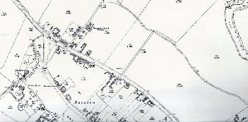
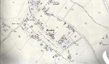
The following images are from the 25 inches to the mile Ordnance Survey maps of the 2nd edition (1901) and the 3rd edition (1926). To see a larger version, please click on the image.
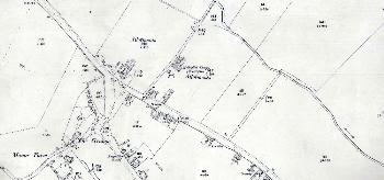
The northern part of Beeston in 1901
The northern part of Beeston in 1926
The southern part of Beeston in 1901
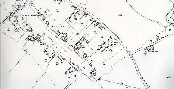 The southern part of Beeston in 1926