Battlesden Gas Works
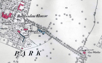
The 1882 map showing the gasometer and gas works
It seems surprising that a village so small as Battlesden ever had a gas works, complete with gasometer. The reason, it seems logical to suppose, was Battlesden House. The gas works and gasometer are shown on the 1st edition 25 inches to the mile Ordnance Survey map of 1882, as seen above.
The old Battlesden House was demolished and a thoroughly new, modern house built in 1864. This new house was, in its turn, demolished in 1886. The gas works is noted in a newspaper report of the previous year as having already been demolished and, certainly, it does not appear on the 1901 second edition 25 inches to the mile Ordnance Survey Map. In the photograph below the gas works was just off the road in front of the clump of trees in the centre of the shot.
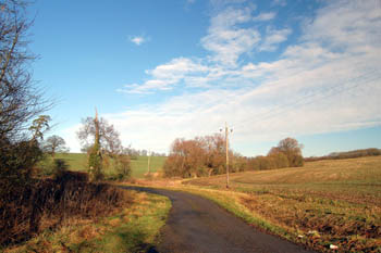
The site of the former gas works in January 2008
It therefore seems reasonable to conclude that the gas works had a very short life, lasting from just 1864 to 1885. Interestingly, the later Battlesden House was also gas powered when used as a Nursing Home in the early 20th century, but this gas was provided from a small plant in the grounds.