The Parish of Tingrith in General
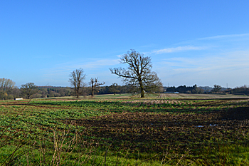
Looking from the church towards the M1 February 2016
Landscape
Tingrith is mostly based on a solid geology of Woburn Sands Formation, a smectite-claystone, synonymous with Fullers earth. It was formed between 99 and 121 million years ago in the shallow seas of the Cretaceous Period. The soil comprises marl, clay and sand with some gravel.
The parish was poorly provided with natural water. Crops include wheat, barley, oats, beans and peas. The church stands 313 feet above sea-level. The land falls away to 269 feet to the north.
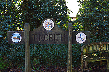
Name
The Place Names of Bedfordshire and Huntingdonshire by A Mawer and F M Stenton 1926 “Assembly brook”
- Tingrei: 1086;
- Tyngri: 1220-1365;
- Tingri: 1220-1365;
- Tyngry: 1220-1365;
- Tingrye: 1220-1365;
- Tingerithe: 1247;
- Tyngrithe: 1276-1509;
- Tyngryth: 1276-1509;
- Tingrith: 1276 to date;
- Tyngre: 1346-1489;
- Tingryffe: 15th century -1605;
- Tyngreve: 1504;
- Tyngriff: 1526-1566;
- Tyngryff: 1526-1566;
- Tingrif: 1526-1566;
- Tingreth: 1598;
- Tyngrave: 1626-1646;
- Tyngeriff: c. 1690
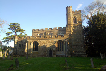
Tingrith church from the north April 2009
Administrative History
Tingrith is an ancient parish in the Manshead Hundred. It is surrounded by Flitwick to the north-east, a detached part of Harlington (now Westoning) to the east, Toddington to the south and Eversholt to the north and west.
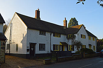
11 to 17 High Street February 2016
Population
In 1086 the Tingrith estate consisted of two hides and one virgate and contained four villagers and two smallholders. This gives a total population of six villagers, as this number represents the heads of household, to get an idea of the total population it is probably necessary to multiply this figure by a factor of at least four suggesting a total population to somewhere around 24.
Census figures from 1801 are as follows:
- 1801: 116;
- 1811: 128;
- 1821: 155;
- 1831: 162;
- 1841: 158;
- 1851: 196;
- 1861: 226;
- 1871: 213;
- 1881: 167;
- 1891: 155;
- 1901: 151;
- 1911: 129;
- 1921: 129;
- 1931: 120;
- 1951: 132;
- 1961: 114;
- 1971: 166;
- 1981: 166;
- 1991: 134;
- 2001: 147;
- 2011: 153