Stagsden Maps
The following maps are only a selection of those held at Bedfordshire and Luton Archives and Records Service. To see a larger version of each map, please click on the relevant thumbnail.
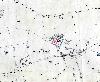
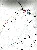
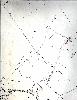
Stagsden Estate Map of 1799-1800
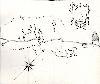
This estate map [X1/98/5] has a key attached; the surveyor was Richard Gee of Turvey; the owner of the estate is not noted.
1. Becks Ashes - 5 acres 3 roods 22 perches
2. Becks Ashes - 3 acres 0 roods 22 perches
3. Becks Ashes - 5 acres 2 roods 17 perches
4. New Close - 3 acres 0 roods 22 perches
5. The Drab - 4 acres 1 rood 22 perches
6. Two lands - 0 acres 1 rood 32 perches
7. One land - 0 acres 0 roods 32 perches
8. Two lands - 0 acres 2 roods 17 perches
9. Two lands 0 acres 1 rood 6 perches
10. A piece - 0 acres 3 roods 17 perches
11. One land - 0 acres 1 rood 24 perches
12. One land - 0 acres 0 roods 29 perches
13. One land - 0 acres 0 roods 16 perches
14. Four lands - 0 acres 2 roods 17 perches
15. Four lands - 0 acres 2 roods 22 perches
16. One land - 0 acres 1 rood 9 perches
17. Seven lands - 0 acres 3 roods 0 perches
18. Two lands - 0 acres 1 rood 13 perches
19. A piece - 0 acres 1 rood 26 perches
20. One land - 0 acres 0 roods 25 perches
21. Ghost Hole - 1 acre 0 roods 4 perches
22. One lay - 0 acres 1 rood 16 perches
23. Two lands - 0 acres 1 rood 13 perches
24. Farm house, buildings, yard and garden - 1 acre 1 rood 23 perches
25. Home Pightle - 3 acres 1 rood 4 perches
26. Chime Mead - 3 acres 1 rood 29 perches
27. Four lands - 0 acres 3 roods 30 perches
Burdelys Manor, North End, Wick End and Dropshort

Stagsden Village

North End
West End
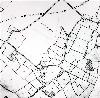
Ordnance Survey 1st Edition 25 Inches to the Mile of 1883
Bury End
Dropshort
Firs Farm
West Farm and Park Farm
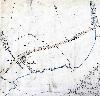
Ordnance Survey 3rd Edition 25 Inches to the Mile of 1926

Stagsden Village

Wick End