The Parish of Sandy in General
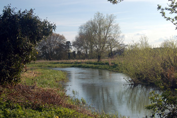
The River Ivel at Ivel Road April 2010
Landscape
The Great North Road, the modern A1 forms the western boundary of the town of Sandy but not of the whole parish. The land slopes generally south-east to north-west and the highest point is on Potton Road on the high ground east of the town, standing at about 240 feet above sea-level; the lowest point is along the river Ivel south of the town which lies at round 72 feet. The church is just over a hundred feet above sea-level and Sandy Lodge just over a hundred feet higher than this.
Volume II of The Victoria County History for Bedfordshire was published in 1908 and states that parish comprised 4,276 acres of which just over half is given over to arable farming, 781 acres were permanent grass and 552 acres were woods and plantations.
Along the river the solid, or underlying, geology is a mudstone called Oxford Clay Formation laid down between 154 and 164 million years ago in the warm, shallow seas of the Jurassic Period. It also lies under the northern parts of the town enclosed roughly by Sunderland Road and Saint Neots Road.
Most of the town as well as Sandy Heath sits on a solid geology of Woburn Sands Formation, a sandstone laid down in Cretaceous seas between 99 and 121 million years ago. This sandstone gives rise to sandy soils, as the name of the town suggests. Along Saint Neots Road is a mixed area of sand, gravel, clay and silt forming a river terrace deposit. Along the banks of the river is an alluvium forming a similar mixture.
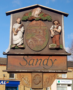
Sandy sign March 2010
Name
Sandy is first recorded in the Domesday Book of 1086; the name means "sand island". The name has had a number of variations over the years:
- Sandeie: 1086-1185;
- Sandun: 1197-1206;
- Sandon: 1197-1206;
- Sandee: 1202;
- Saundee: 1202;
- Saundeye: 1227-1399;
- Sondy: 1247;
- Sandheye: 1287;
- Sondey: 1287-1489;
- Sondeye: 1287-1489;
- Sonday: 1507-1547;
- Sondheye: 1535.
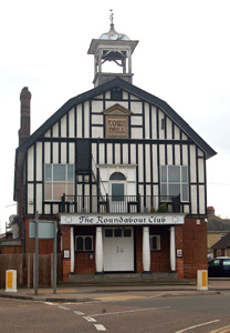
The former Town Hall March 2010
Administrative History
Sandy is an ancient parish which lay partly in the Barford Hundred and partly in the Wixamtree Hundred. The parish includes the hamlets of Girtford, which lay north of Sandy and is today part of the town, Beeston to the south-west, Seddington to the south and Stratford to the south-east. Until the late 19th century Beeston was considered to be at least partly in the parish of Northill as the Administrative History section of that community's general page explains. From 1927 to 1974 Sandy had its own Urban District Council
The parish is bordered by Blunham to the north-west, Tempsford to the north, Everton to the north-east, Potton to the east, Sutton to the south-east, Biggleswade to the south, Northill to the south-west and Mogerhanger to the west.
![The Great Northern station at Sandy in the 19th century [Z50/99/7]](/CommunityHistories/Sandy/SandyImages/The Great Northern station at Sandy in the 19th ce.jpg)
The Great Northern station at Sandy in the 19th century [Z50/99/7]
Population
The Domesday Book of 1086 lists twenty four villagers, six smallholders and two slaves in Sandy. This, of course, only accounts for heads of households and must be multiplied by a factor of at least four to allow for wives and children, suggesting a total population of around a hundred and thirty people, a quite substantial settlement. At no point in the 19th and 20th centuries did Sandy's population fall below a thousand and it gradually grew in size to today's figure - the ninth most populous civil parish in the county. As is usual the most significant increases have been since the Second World War, in Sandy's case as it became a receptacle for the so-called London Overspill.
- 1801: 1,115;
- 1811: 1,122;
- 1821: 1,392;
- 1831: 1,617;
- 1841: 1,906;
- 1851: 1,946;
- 1861: 2,118;
- 1871: 2,482;
- 1881: 2,662;
- 1891: 2,755;
- 1901: 3,110;
- 1911: 3,377;
- 1921: 3,409;
- 1931: 3,140;
- 1951: 3,667;
- 1961: 3,963;
- 1971: 5,277;
- 1981: 8,048;
- 1991: 8,797;
- 2001: 10,887;
- 2011: 11,651.