The Parish Of Oakley in General
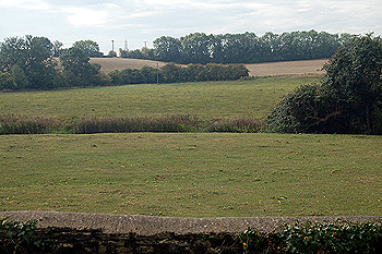
Oakley countryside looking south from the churchyard August 2011
Landscape
Oakley lies in the valley of the River Great Ouse which, in fact, forms the boundary of the parish (except in the east) because the river flows in a huge westward bow at this point in its course. In 1912 Volume III of The Victoria County History for Bedfordshire stated that just under half the 1,786.5 acres of the parish was arable land, and nearly 40% grassland, the rest being woods and, of course, the inhabited areas of the village.
The village lies in the south-east of the parish. The land is all low lying, especially bordering the river where it is liable to flooding. The highest part of the parish lies to the east, Oakley Hill being 279 feet above sea-level. The church is about 125 feet above sea-level and Oakley House about 145 feet. The Bedford Arms is about 155 feet above sea-level and the war memorial about 175. Railway Cottages are about 155 feet above sea-level and the Lovell Almshouses, like the church, about 125 feet. Westfield Farm in the far west of the parish is about 130 feet above sea-level.
The geology of the parish is complex. Along the river the solid, or underlying, geology is an interbedded limestone and clay mineral rock called Great Oolite Group laid down between 164 and 169 million years ago in the warm, shallow seas of the Jurassic Period. Moving east are bands of cornbrash, laid down between 159 and 169 million years ago, then a mixture of sandstone and mudstone called Kelleways Formation laid down between 159 and 164 million years ago. Most of the village lies on the cornbrash.
The soil usually reflects the underlying geology, sand or clay but along the river the superficial geology is an alluvium of sand, silt, gravel and clay with a river terrace deposit of sand and gravel forming an outer band to this. There is some glacially deposited till in the east of the parish.
Name
The name Oakley comes from the Anglo-Saxon word “leah” meaning a clearing in woodland. Thus the name means oak clearing. The name has appeared in the following forms over the years with the modern form first appearing about 1750:
- Accleya: 1060;
- Achelai: 1086;
- Achelea: 1174;
- Akelai: 1176-1179;
- Akelay: 1176-1179;
- Aklye: 1220;
- Akle: 1227-1428;
- Acle: 1236-1307;
- Ocle: 1247-1414;
- Okle: 1276-1378;
- Oklee: 1276-1378;
- Okele: 1390-1428;
- Ocley: 1402-1538;
- Occley: 1535;
- Ockley: 1574;
- Ockeley: 1605;
- Ockley: c. 1750
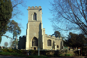
The church from the west March 2011
Administrative History
Oakley is an ancient parish. Originally it included the chapelry and hamlet of Clapham, which became a separate parish only in 1545. Oakley is bordered east by Clapham, south by Bromham, south-west and west by Stevington and north by Pavenham and Milton Ernest.
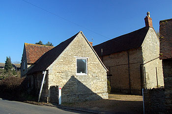
Middle Farmhouse March 2011
Population
The Domesday Book of 1086 records 17 people in Oakley. These are just the heads of households and so the figure must be multiplied by a factor of at least four, suggesting around 70 people.
Historically Oakley was a small village but since 1931 the population has quintupled. The twenty years between 1961 and 1981 saw a quadrupling of numbers as massive new housing schemes were built. The following figures are taken from census returns.
- 1801: 265;
- 1811: 432;
- 1821: 486;
- 1831: 516;
- 1841: 492;
- 1851: 457;
- 1861: 443;
- 1871: 378;
- 1881: 295;
- 1891: 250;
- 1901: 299;
- 1911: 330;
- 1921: 337;
- 1931: 508;
- 1951: 478;
- 1961: 624;
- 1971: 1,335;
- 1981: 2,283;
- 1991: 2,333;
- 2001: 2,438;
- 2011: 2,493.