The Community of Lower Dean in General
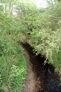
The River Til May 2011
Landscape
Both Upper and Lower Dean lie on a solid geology of Oxford Clay, formed between 154 and 164 million years ago in the Cretaceous Period. Along the River Til is a superficial geology of alluvium - a mixture of sand, gravel, silt and clay. Immediately north of the river is a band of river terrace deposit of sand and gravel and some patches of gravel in the valleys eroded by the river and its tributary stream lie on the surface.
The village of Lower Dean lies about 150 feet above sea-level. This is, on average, 30 feet or more lower than Upper Dean.
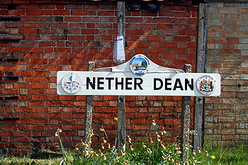
The Lower or Nether Dean sign May 2011
Name
Dean is a modernisation of the Anglo-Saxon word “denu” meaning valley. In this case it would be the valley of a tributary stream joining the River Til at Lower Dean or Nether Dean as it is also known.
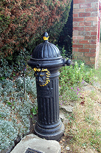
A lion head standpipe May 2011
Administrative History
Lower Dean was a hamlet of the ancient parish of Dean. In 1934 the civil parish was joined with neighbouring Shelton to form the parish of Dean and Shelton. The ecclesiastical parish of Dean remains separate, the church being in Upper Dean, but is included in the Team Ministry of the Stodden Churches with the ecclesiastical parishes of Shelton, Swineshead, Pertenhall, Melchbourne and Yielden. Dean is bordered by Shelton to the north-west, Yielden to the west, Melchbourne top the south, Swineshead to the south-east, Tilbrook (once in Bedfordshire but, since 1897 in Huntingdonshire then Cambridgeshire) to the east and north-east, Covington[Cambridgeshire] to the north and Hargrave Northamptonshire] to the north-north-west
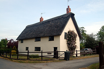
Elm Farmhouse May 2011
Population
Dean is not a large parish today but was more populous in the past. In 1086 Domesday Book recorded a total of 41 people. These were just the heads of household and the figure should probably be multiplied by a factor of four to give the true figure – somewhere around 160 people. Given that the population of England was only between 1,500,000 and 2,500,000 at that time Dean was obviously a much larger place proportionately than it was in 1801 when the country’s population was over 8,000,000.
The parish had over five hundred people between 1831 and 1871, after which families began to get smaller and people began to leave the land for a number of reasons and seek employment in the nearby towns. The population figures for Dean (Upper and Lower) below are taken from census reports until 1931, the figures from 1951 being for Dean and Shelton combined.
- 1801: 385;
- 1811: 428;
- 1821: 479;
- 1831: 513;
- 1841: 541;
- 1851: 547;
- 1861: 552;
- 1871: 575;
- 1881: 487;
- 1891: 406;
- 1901: 344;
- 1911: 342;
- 1921: 339;
- 1931: 277
For Dean and Shelton:
- 1951: 333;
- 1961: 309;
- 1971: 312;
- 1981: 328;
- 1991: 371;
- 2001: 386;
- 2011: 418.