The Parish of Kempston Rural in General
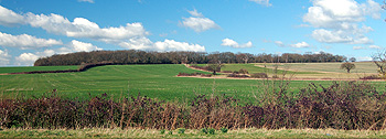
Astey Wood seen from West End Road March 2012
Landscape
The solid, or underlying, geology of Kempston Rural is quite complex. It is mainly composed of types of sedimentary rock known as Great Oolite Group and Oxford Clay Formation. The former is a limestone, inter-bedded with argillaceous rocks laid down between 164 and 169 million years ago in the warm, shallow seas of the Jurassic Period. The latter is a mudstone laid down between 159 and 164 million years ago. Great Oolite Group lies beneath the river, under the area around the church and under Box End Road. Oxford Clay lies under Green End, Gibraltar, Wood End and West End.
To complete the picture two other types of sedimentary rock lie beneath parts of the parish. Kelleways Sand Mamber, a mixture of sandstone and siltstone formed between 159 and 164 million years ago lies beneath Rushey Ford and beneath parts of Box End. Kelleways Clay Member, a mixture of sandstone, siltstone and mudstone formed at the same time lies beneath parts of Box End.
The superficial geology is also complex. Each side of the river is a band of alluvium, a mixture of sand, gravel, silt and clay laid down in the last two million years by the action of the river. Further from the river this turns into a river terrace deposit of sand and gravel laid down at the same time, again by the river itself. A mixture of silt, clay, sand and gravel called head forms the soil at Green End and Gibraltar, although there is a band of glacio-fluvial deposit along the main road to Wootton. This is a mixture of sand and gravel laid down by ice sheets during the ice ages of the last two million years. More head is found at Rushey Ford and at Box End.
Being close to the river much of the parish is quite low-lying, although the land does rise to the west. All Saints’ church, right next to the river, stands at 106 feet above sea-level. Box End House is 114 feet above sea-level and the Slaters Arms at Box End 137 feet. Crossland Fosse lies at 136 feet but , as the name suggests, is higher at 182 feet above sea-level.
Kempston House at Green End is 156 feet above sea-level and Rushey Ford House, 144 feet. The Cross Keys at Wood End is 154 feet above sea-level. The junction of Tithe Road with West End Road is 148 feet above sea-level and the top of the hill at Hay Lane in West End is 228 feet.
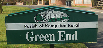
Green End sign March 2012
Name
The name Kempston was first recorded in 1060 as Kemestan, in the Domesday Book it is Camestone. It is first recorded in its modern form in 1247. The name is not an easy one to determine. The second syllable is the Old English “tun” meaning farm or settlement. It has been suggested [Bedfordshire Place Names published 1926, page 76] that the first element may relate to the bend in the River Great Ouse and come from the Celtic “cambo” meaning crooked, thus “farm in the crook of the river”.
The name has undergone a number of variations over the years as the following shows:
- Kemestan 1060-1199;
- Cœmbestun c.1060;
- Cæmbestune (1077);
- Camestone (1086-1200);
- Canbestuna (1124-1128);
- Kembeston (1176-1402);
- Kemeston (1189-1332);
- Kamistuna: 1195;
- Camestun: 1195;
- Chemiston: 1199;
- Cemeston: 1199;
- Cambesdon: 1201;
- Kimbeston: 1201;
- Cambeston: 1236;
- Kemston: 1236-1349;
- Kembestun: 1237-1253;
- Kemestun: 1241;
- Kemyston: 1242;
- Kempston: 1247 onwards;
- Kempeston: 1276-1306;
- Kemmeston: 1276;
- Camston: 1328;
- Cameston: 1332
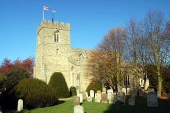
The church from the south November 2007
Administrative History
Kempston Rural was once part of the ancient parish of Kempston, in the Redbornestoke Hundred. In 1896 the decision was taken to divide the parish into two – Kempston Urban (now simply Kempston) and Kempston Rural. Volume III of The Victoria County History for Bedfordshire was published in 1912. At this date Kempston Urban comprised 1,255 acres and Kempston Rural three times the size at 3,770 acres. 2,102 acres was used for arable purposes of which the vast majority, 2,043 acres, was permanent grass for grazing animals, another 52 acres was covered by woods and plantations.
Kempston Rural had three minor boundary changes in the 20th century. These were in 1934, when a small area was lost to Kempston [CDP54/5]; in 1947 when an area in the north of the parish extending to the River Great Ouse and including Thistley Green was lost to Bromham [MCDP59] and in 1989 when Ridgeway School and the Child Development Centre were transferred to Kempston [CDP89].
The ecclesiastical parish of Kempston, centred on All Saints church, remained unchanged until the last quarter of the 20th century. The Church of the Transfiguration was opened in 1940 but remained a chapel of ease of All Saints until 1976 when the Transfiguration became a parish church in its own right, for the new ecclesiastical parish covering the urban area of Kempston.
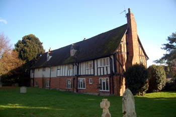
Church Cottages November 2007
Population
The first ten censuses all included the population of the rural parts of Kempston with those of the urban. 1901 was the first census to see Kempston Rural a separate civil parish. The figures since then are as follows:
- 1901: 719;
- 1911: 648;
- 1921: 656;
- 1931: 730;
- 1951: 1,171;
- 1961: 1,289;
- 1971: 1,306;
- 1981: 1,276;
- 1991: 1,163;
- 2001: 1,272;
- 2011: 1,184.
It is interesting to reflect that since 1951 the population of Kempston Rural alone has been greater than the population of the whole ancient parish of Kempston in 1801.