The Community of Ireland and Rowney in General
133 to 136 Ireland March 2008
Landscape
Ireland lies around 225 feet above sea level, the height at the Black Horse. Rowney Warren Wood lies between about 155 (in the south-east) and 280 (in the north-west) feet above sea level.
The solid, or underlying, geology varies. The village of Ireland, most of Old Rowney Farm and Keeper's Farm, for example, lie on a type of sandstone known as Woborn Sands Formation, laid down between 99 and 121 million years ago in the shallow seas of the Cretaceous Period. The soil here is, therefore, sandy. A thin band of mudstone called Oxford Clay Formation laid down between 154 and 164 million years ago in the Jurassic Period lies on part of the land of Old Rowney Farm where the soil is a glacial deposit of sand and gravel laid down during the mid Pleistocene Epoch. New Rowney Farm lies on a type of mudstone known as Gault Formation laid down between 99 and 112 million years ago. The soil here is glacial till.
Name
The name Ireland is comparatively recent, being recorded as Inlonde in the 16th century. Rowney is an older name, being first recorded in 1286 as Rueye, it was Runheye in 1252 and Rounhey or Rouney in 1291 and 1297, Roundhey in 1535. The name is from the Old English "ruhan hæge" meaning "rough enclosure".
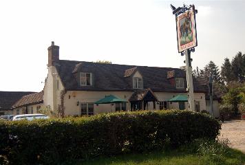
Black Horse Ireland April 2007
Administrative History
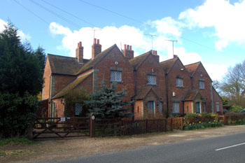
Ireland and Rowney are hamlets in the parish of Southill, in the Hundred of Wixamtree, lying south-west of the main village. They comprise a scattering of farms, a few houses and a public house (the Black Horse at Ireland).