Houghton Conquest Maps
The image below is part of the inclosure map for Houghton Conquest, dated 1809 [MA69/2]. To see a larger version please click on the image.
![Houghton Conquest in 1809 [MA69-2]](/CommunityHistories/HoughtonConquest/Houghton-Conquest-Images/Houghton-Conquest-in-1809-MA69-2350x247.jpg) Houghton Conquest in 1809
Houghton Conquest in 1809
The image below is part of the tithe apportionment map for Houghton Conquest of 1843 [MAT24]. Together with the accompanying apportionment it would describe how much money landowners were to pay in tithes to the rector per annum. To see a larger version please click on the image.
![Houghton Conquest in 1843 [MAT24]](/CommunityHistories/HoughtonConquest/Houghton-Conquest-Images/Houghton-Conquest-in-1843-MAT24212x299.jpg) Houghton Conquest in 1843
Houghton Conquest in 1843
The three maps below are part of the 2nd edition Ordnance Survey 25 inches to the mile series for the county. To see a larger version please click on the image.
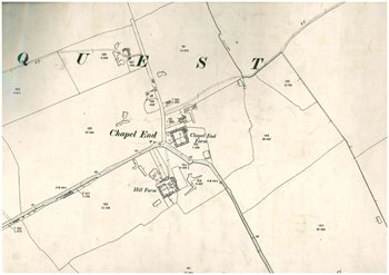
Chapel End in 1901
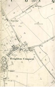
The greater part of the village in 1901
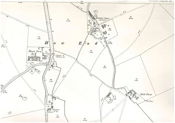 How End in 1901