The Community of Chaul End in General
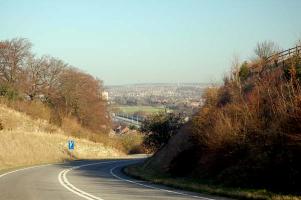
The view over Luton from Chaul End - March 2007
Landscape
Chaul End stands on a chalk ridge in the north-east part of the parish of Caddington. Chaul End Farm stands at 625 feet above sea-level.
The underlying, or solid geology is a type of chalk known as Lewes Nodular Chalk Formation and Seaford Chalk Formation. This sedimentary rock was laid down between 84 and 94 million years ago in the warm seas of the Cretaceous Period.
The soil is mostly clay with flints which was laid down up to 5 million years ago in the Quarternary and Neogene Periods. The valley to the south has a type of soil known as head – a mixture of sand, clay, silt and gravel formed in the Quarternary Period up to 2 million years ago through drainage during Ice Ages.
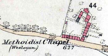
The Methodist Chapel and houses in 1880
Administrative History
There has been a settlement At Chaul End since at least the early Middle Ages has always formed part of the ancient parish of Caddington and, although Caddington itself was, for much of its history divided between Bedfordshire and Hertfordshire, Chaul End has always been in Bedfordshire
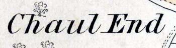
Name
The names Chalveleye, Challeye, Challe and Chaleie are recorded in manorial surveys and land tax returns from the late 13th century onwards [CRT130CAD4/2]. These forms of the name do not seem to support the most obvious meaning of the name – Chalk End – it may be more likely to mean Calf End.
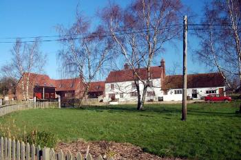
Chaul End Farm March 2007
Population
The settlement has never been large - in 1800 it included three farms and two other tenements and did not expand very much during the 19th century, greater residential development occurring during the twentieth century. A large area of land south-east of the farm and area of settlement was laid out by Vauxhall Motors of Luton as a vehicle test circuit, though this was later used for vehicle storage, rather than testing.
The medieval landscape divided a parish up into one or more large fields, with people having a varying number of strips in those fields. Chaul End Field was one such large field. Then, from the 16th to the 18th century enclosures were made in these large fields - that is to say individuals carved out smaller fields for themselves so that by the time the parish as a whole was inclosed in 1800 much of Chaul End Field had already been divided into much smaller closes and these, together with the subdivision of the remainder of the large field into smaller parcels of land gave us the field system we have today.