Cardington Maps
The following maps are only a selection of those held at Bedfordshire and Luton Archives and Records Service.
The map below shows the village of Cardington in 1794. It is taken from the inclosure map for the parish [W2/6/1]. Please click on the image to see a larger version.
![Map of Cardington in 1794 [W2-6-5]](/CommunityHistories/Cardington/CardingtonImages/Map of Cardington in 1794 [W2-6-5]_350x209.jpg)
Map of Cardington in 1794 [W2/6/1]
The maps of the village of Cardington below are from the Ordnance Survey 25 inches to the mile 2nd series of 1901.
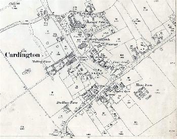
The main part of the village in 1901
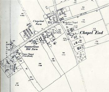
Chapel End in 1901