The Parish of Biddenham in General
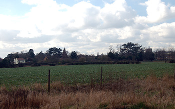
Looking from Duck End to Church End March 2012
Landscape
Biddenham lies due west of Bedford and south-east of the River Great Ouse. Volume III of The Victoria County History for Bedfordshire was published in 1912, at that date the parish comprised 1,585 acres, 3 roods of which 798 acres, 2 roods were used for arable farming, 606 acres, 3 roods were permanent grass and 4 acres were woods and plantations. The main crops were turnips, wheat, barley and peas. The creation of the designer golfing community of Great Denham took place in the south of the parish and when Great Denham became a civil parish in 2007 Biddenham lost more than half its area.
As one might expect so close to a major river, Biddenham is low lying. The church stands about 125 feet above sea level and the meadows at the Biddenham end of Bromham Bridge are just 105 feet. A low ridge in the north of the parish includes the site of the former windmill and gets up to just over 150 feet above sea level.
The underlying, or solid, geology of the village is a type of sandstone called Kelleways Formation, laid down between 159 and 164 million years ago in the warm, shallow seas of the Jurassic Era. North of Main Road the soil is a mix of sand, gravel, silt and clay known as river terrace deposit, south of this the soil is more evenly sandy. Along the River Great Ouse the underlying geology is a type of intermixed limestone with clay minerals called the Great Oolite Group, laid down between 164 and 169 million years ago. A band of Cornbrash forms an inverted U of underlying geology, the two ends resting just north of Church Farm and at the junction of Bromham Road with Biddenham Turn, the only area where housing lies on top of it.
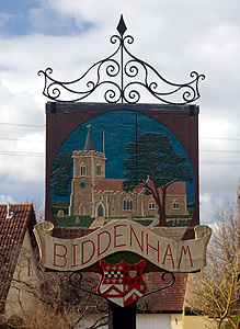
Biddenham sign March 2012
Name
The name Biddenham means “cultivated land belonging to Byda”. The name has had a number of changes over the years as shown below:
- Bideham: 1086-1347;
- Bidenham: 1086-1316;
- Beydenham: 1240;
- Budeham: 1247;
- Bydenham: 1276-1428;
- Bedenham: 1276-1535;
- Budenham: 1276;
- Bedenham alias Biddenham: 1312;
- Bydyngham: 1362;
- Bedyngham: 1428;
- Bydnam: 1512-1535;
- Byddyngham: 1535;
- Bignam: c. 1550.
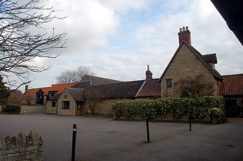
The Village Hall March 2012
Administrative History
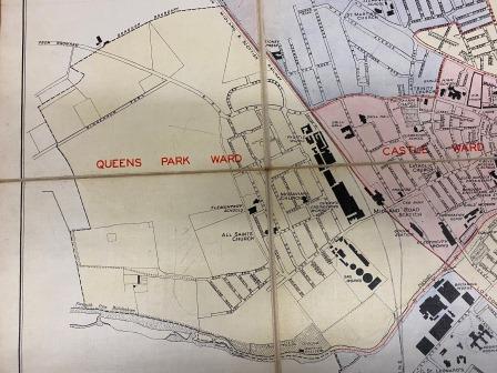
Bedford map showing Ford End and Biddenham Turn 1934 [BorBK1/1]
Biddenham is an ancient parish and once stretched into what is now Bedford, there having been a Ford End, Biddenham immediately west of Ford End, Bedford. The parish lost its own Ford End to Bedford in 1934. At that time Biddenham Turn (New Road) and part of Bromham Road that is now in Biddenham were also included in the Queens Park ward of Bedford. In the whole of the southern part of the parish, more than half the area, was taken to form the new civil parish of Great Denham in 2007. At the time of writing [2012] Biddenham is bounded by Kempston Rural to the south-west; Bromham to the west and north, Bedford to the east and Great Denham to the south.
![Three Gables about 1900 [Z50/15/11]](/CommunityHistories/Biddenham/BiddenhamImages/Three Gables about 1900 [Z50-15-11].jpg)
Three Gables about 1900 [Z50/15/11]
Population
The Domesday Book of 1086 recorded that Biddenham contained nine villagers, five smallholders and five slaves – a total of nineteen. These were just the heads of households so to account for dependants the number probably needs to be multiplied by a factor of at least four, suggesting a total population of around eighty people, a reasonable size for the day. The following figures are taken from censuses:
- 1801: 252;
- 1811: 310;
- 1821: 393;
- 1831: 369;
- 1841: 345;
- 1851: 373;
- 1861: 350;
- 1871: 325;
- 1881: 308;
- 1891: 352;
- 1901: 325;
- 1911: 451;
- 1921: 460;
- 1931: 568;
- 1951: 503;
- 1961: 693;
- 1971: 728;
- 1981: 807;
- 1991: 1,183;
- 2001: 2,620.