The Community of Wootton Green in General
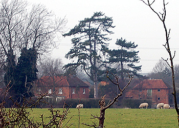
Wootton Green Farm March 2012
Landscape
Most of Wootton Green stands on an underlying geology of a type known as Peterborough Member. This is a mudstone laid down between 164 and 176 million years ago in the warm, shallow seas of the Jurassic Period. The western area of the settlement the underlying geology is Oxford Clay, laid down between 154 and 164 million years ago. Wootton Green stands around 155 feet above sea level on average.
Administrative History
The name would suggest that the settlement is a hamlet of Wootton and this is probably how it was anciently regarded. At the present [2013] however, Wootton Green is divided between Wootton and Marston Moretaine.
This means that, following the abolition of Bedfordshire County Council in April 2009 the settlement falls into two unitary council areas. All that part of the settlement north of the Cranfield Road and east of Hoo Lane is within the parish of Wootton and so forms part of Bedford Borough. Some of the dwellings south of the road east of Hoo lane are also in Wootton but others are in Marston Moretaine and so part of the Central Bedfordshire unitary council area.