The Community of Woodside in General
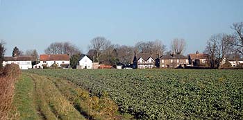
Approaching Woodside from Slip End March 2007
Landscape
The junction between Woodside Road and Grove Road stands at 546 feet above sea level. The solid or underlying geology is a type of chalk known as Lewes Nodular Chalk Formation and Seaford Chalk Formation. It was laid down between 84 and 94 million years ago in the warm chalk seas of the Cretaceous Period. The superficial geology is clay with flints, laid down up to five million years ago in the Quarternary and Neogene Periods.
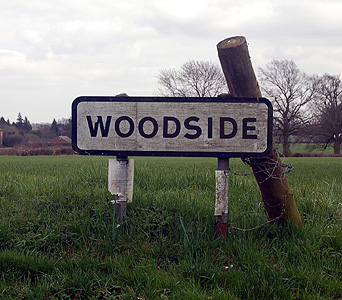
Woodside sign March 2012
Name
The name Woodside is self explanatory. It is likely that the original settlement of Woodside occurred through clearing the northern end of Caddington Wood (hence its linear shape), probably by squatters seeking land and dwellings outside the Manor at some time in the early Middle Ages. Most of the settlement stands on higher ground between two parallel valleys. The squatter development of Woodside continued into the sixteenth and seventeenth centuries as Caddington Manor Court rolls indicate [CRT130CAD1].
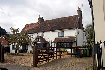
185 Woodside Road March 2012
Administrative History
Woodside traditionally formed part of the ancient parish of Caddington. In 1892 an ecclesiastical parish of Woodside was created. Oddly the church which forms the heart of the parish lies closer to Slip End than to Woodside.
Woodside continued to be part of the civil parish of Caddington and was the responsibility of Caddington Parish Council (latterly called Caddington & Slip End Parish Council). On 10th October 2000 the new civil parish of Slip End was formed and Woodside now forms part of this parish.