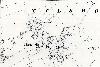
Tilsworth Maps
The following maps are only a selection of those held at Bedfordshire and Luton Archives and Records Service.
An annotated map of Tilsworth in 1804 is shown on the Tilsworth Estate Sale of 1804 page. To see a larger version of each map, please click on the appropriate thumbnail.
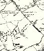
Tilsworth shown on Bryant's Map of Bedfordshire of 1826

The area around Tilsworth church on the Second Edition Ordnance Survey 25 Inches to the Mile Map of 1901
The main part of the village on the Second Edition Ordnance Survey 25 Inches to the Mile Map of 1901