Kempston Rural Maps
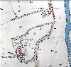
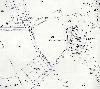
This map shows Kempston Rural in 1804 [X1/25]. To see a larger version please click on the image.
![Kempston Rural in 1804 [X1-25]](/CommunityHistories/KempstonRural/KempstonRuralImages/Kempston Rural in 1804 [X1-25]_150x89.jpg)
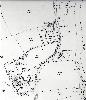
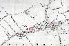
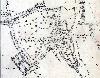
To view a larger version of the 25 inch to the mile Ordnance Survey map you wish to see, please click on a relevant thumbnail
Box End
Box End north 1883
Box End north 1926
Box End south 1883
 Box End south 1926
Church End
Church End 1883
Church End 1926
Green End

Green End 1883

Green End 1926
West End

West End 1883

West End 1926
Wood End

Wood End 1883

Wood End 1926