Clifton Maps
The following maps are only a selection of those held at Bedfordshire and Luton Archives and Records Service. To see a larger image, please click on the thumbnail of the appropriate map
Before the 1880s
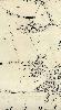
![The area of the village in 1799 [X1-58]](/CommunityHistories/Clifton/CliftonImages/The area of the village in 1799 [X1-58]_100x75.jpg)
The area of the village in 1799 [X1/58]
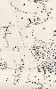
![A tracing of the Clifton inclosure award of 1832 [MA59] showing the village](/CommunityHistories/Clifton/CliftonImages/A tracing of the Clifton inclosure award of 1832 [_105x98.jpg)
A tracing of the Clifton inclosure award of 1832 [MA59] showing the village
1882-1883

The eastern part of Clifton in 1882

The western part of Clifton in 1883
1901

The eastern part of Clifton in 1901
The western part of Clifton in 1901
1923-1924

The eastern part of Clifton in 1924
The western part of Clifton in 1923